Walking in the UK | The 8 best hiking routes in Northern Ireland
- Overview
- What’s special about hiking in Northern Ireland?
- Must visit outdoor attractions in Northern Ireland
- Explore Northern Ireland by water
- 1. Portglenone Forest Walk
- 2. Giant’s Causeway Coastal Walk
- 3. Cave Hill Country Park
- 4. Ballyboley Forest Walk
- 5. Blue Lough Trail
- 6. Stairway to Heaven Boardwalk
- 7. Slieve Donard Climb
- 8. Portballintrae to Ballintoy Coastal Walk
- Related articles
What’s special about hiking in Northern Ireland?
Northern Ireland is so renowned for its rugged coastline that it’s easy to overlook the number of stunning national parks that it’s home to. This diverse blend of jagged rock and luscious grassland makes Northern Ireland one of the most visually captivating hiking locations in the UK.
Because of its compact size, visiting Northern Ireland means you can explore diverse landscapes and experience rich history all in the space of twenty-four hours. The unique blend of nature, myths, and culture on offer in rural Northern Ireland means there really is something for everyone.
Must visit outdoor attractions in Northern Ireland
Be sure to visit the Causeway Coast Way, where stripped back coastline exposes the islands bare bones. Taking a walk along the famous Giant's Causeway gives you a glimpse of the natural architecture of the area and an insight into life millions of years ago.
If you’re all about ancient human history, the Sperrin Mountains are home to mysterious ancient stone circles and folklore legends for you to get lost in. If landlocked bodies of water are more your thing, the Glens of Antrim contain lush valleys and serene glacial lakes, while the Fermanagh Lakelands are home to tranquil waterside paths to meander beside and get lost on.
Explore Northern Ireland by water
Wherever you are, there’s water in Northern Ireland. From inlets and rivers to the Atlantic Ocean and Irish Sea, there’s opportunities for kayaking, boating, wild swimming, fishing, and canoeing everywhere.
- Surfing at Portrush: portrush is a hotspot for surfers. Consistent waves and the beautifully kept sand, sea surfers flock from miles around to catch north coast waves all year round
- Kayaking in Strangford Lough: kayaking has boomed in popularity in recent years. It’s an accessible alternative to surfing and a great choice for people new to water sports. Explore the stunning waterways on Strangford Lough and get an up close and personal view of the abundant marine life that this picturesque body of water has to offer
- Fishing on the River Bann: if fishing is more your thing, you’ll find yourself right at home on the River Bann. anglers will delight in fishing along the River Bann. The Bann is home to salmon, pike, and brown trout
- Canoeing on the River Foyle: navigate the gentle waters of the Foyle River by canoe. Canoeing is a great activity for families to do with kids. There’s no better way to see and explore the historic city of Derry from a different perspective
- Sailing on Lough Erne: in Northern Ireland, you’re never far from an opportunity to experience something different on the water. The calm waters of Lough Erne's make it a sailing paradise. Charter a boat or join a sailing course to explore the many islands and coves on offer here.
1. Portglenone Forest Walk
- Distance: 1 mile
- Difficulty: easy
- Location: County Antrim
- Portglenone forest walk GPS route
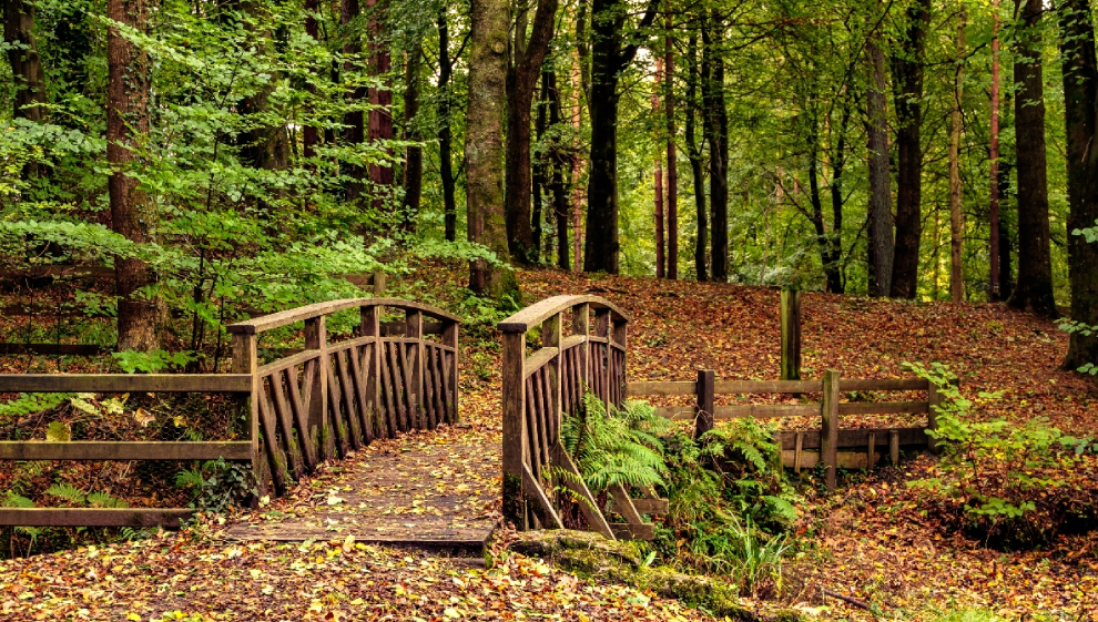
Tucked away east of the village of Portglenone is the tranquil and secluded wooded area known as Portglenone Forest. Frequented by locals on hikes and dog walks, Portglenone Forest is a must for outdoor enthusiasts visiting County Antrim.
Springtime in Portglenone showcases vibrant bluebells and an array of blossoming wildlife that adds to the natural allure of the area. At the western edge lies the Augustine Henry Memorial Garden which is dedicated to the Irish Forestry's pioneer Augustine Henry whose roots trace back to Tyanee, Portglenone.
The garden exhibits the stunning rhododendrons he collected, along with a story-inscribed plaque that makes for an interesting read.
To start your walk through the forest, walk to the eastern public car park. Walking westward leads to the River Bann that flows through the forest. On your route, watch out for diverse woodland birdlife and feel free to take a break at one of the many picnic spots that litter the trail.
If you’re keen on extending your exploration, head west to access the Portglenone Fisherman's Walk. This beloved riverside route takes you along the River Bann which traverses Glenone Forest on the opposite bank. Little pockets of water and inlet streams run off from the Bann, feeding the forest with the water it needs to maintain such a diverse array of flowers and trees.
2. Giant’s Causeway Coastal Walk
- Distance: 2 miles
- Difficulty: medium
- Location: Giant’s Causeway, Coleraine
- Giant’s Causeway coastal walk GPS route
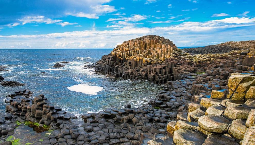
In a 2005 poll, the Giant's Causeway was named as the fourth greatest natural wonder in the UK by Radio Times readers. The Giant's Causeway is a UNESCO World Heritage site on the Northern Ireland coast.
Visited by hundreds of thousands of tourists every year, the Causeway features thousands of unique hexagonal basalt columns formed over millions of years by volcanic activity.
Hiking in the area offers a breathtaking coastal view of the famous Carrick-a-Rede Rope Bridge. Nearby trails like the Causeway Coast Way lead adventurers to stunning visual landscapes, lush valleys, and dramatic cliffs that add a sense of adventure to your hike.
3. Cave Hill Country Park
- Distance: 3 miles
- Difficulty: medium
- Location: Belfast
- Cave Hill Country Park GPS route
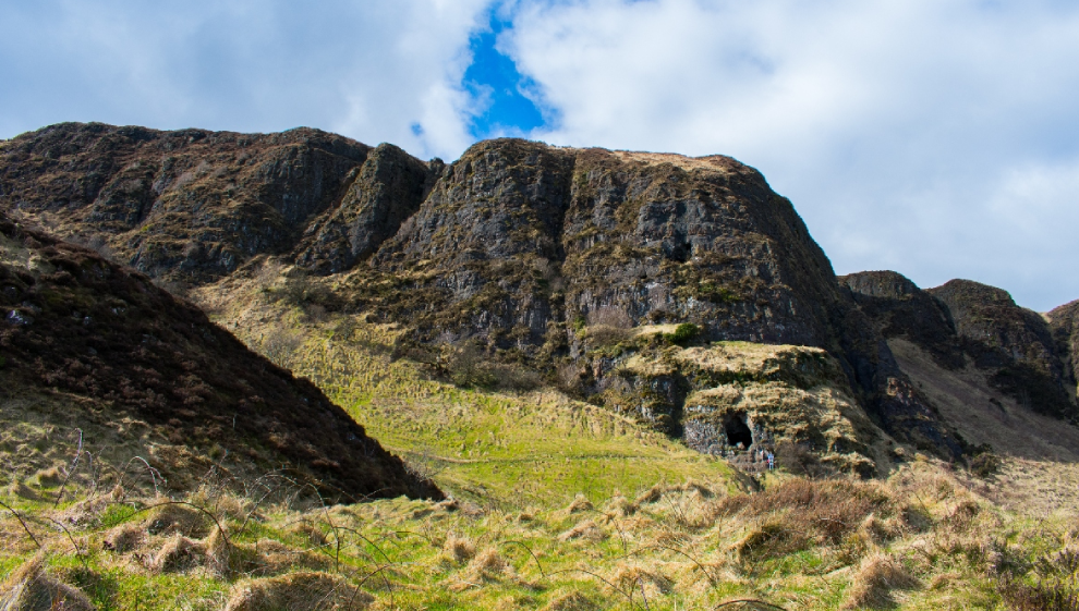
Brimming with cultural and historical significance, Cave Hill Country Park gets its name from the five cave systems the park is home to. These early iron mines are part of a series of important archaeological sites located inside Cave Hill Park.
The beautiful grassland is home to grazing cattle which can be found wandering the hills of the park in packs. The array of walking routes make all areas of the park easily accessible, and the hillside areas provide unrivaled panoramic views of the city of Belfast.
This route traverses the castle estate and takes you on a challenging ascent up to the summit of castle hill, which stands at 370 meters or 1200ft. Along the way, you'll encounter three breathtaking manmade caves and captivating geological formations, including the “'Napoleon's Nose” basaltic outcrop which bears a striking resemblance to the iconic profile of Emperor Napoleon. When you’ve reached the summit, you'll find McArt's Fort and views of the Mourne Mountains, Scrabo Tower, and Slieve Croob.
You can descend using the same route or extend your adventure by following another footpath that transforms your hike into an extended circular. When you’re back down at ground level, refreshments are available at the Belfast Castle restaurant.
From your vantage point at the castle, you’ll see Redburn Country Park on the opposite side of the Belfast Harbour, where yet more picturesque hiking trails await.
4. Ballyboley Forest Walk
- Distance: 6 miles
- Difficulty: medium
- Location: County Antrim
- Ballyboley Forest walk GPS route
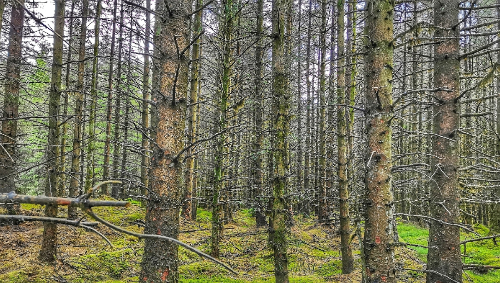
Ballyboley Forest is a unique experience. First planted in 1957, the forest is a relatively new addition to Northern Ireland’s vast walking itinerary.
Located in County Antrim, Ballyboley is host to a lake that supplies water to the local community and a forest that grows timber for the local saw mills. The substantial dam at Killylane supplies the local areas of arne, Ballymena, and Ballyclare with up to three million gallons of water every day.
The expansive forest is conveniently located 30-minutes north of Belfast when traveling by car. A must-see if you’re on a weekend away in Belfast, Ballyboley is just as popular with local dog walkers and outdoor enthusiasts.
Starting at the Kilylane Reservoir car park, you can embark on any number of trails that meander alongside the tranquil waters of the lake. Once you find yourself in the heart of the forest, a delightful circular loop walk leads to the picturesque Kilylane Burn. This serene setting is a haven for woodland birds, who provide a delightful soundscape as you take in views of the Antrim Hills.
Looking for more in Antrim? Consider extending your walk a few miles southeast in Woodburn Forest and the surrounding reservoirs in Carrickfergus.
5. Blue Lough Trail
- Distance: 5 miles
- Difficulty: medium
- Location: Binnian Lough, Mourne Area of Outstanding Natural Beauty
- Blue Lough Trail GPS route
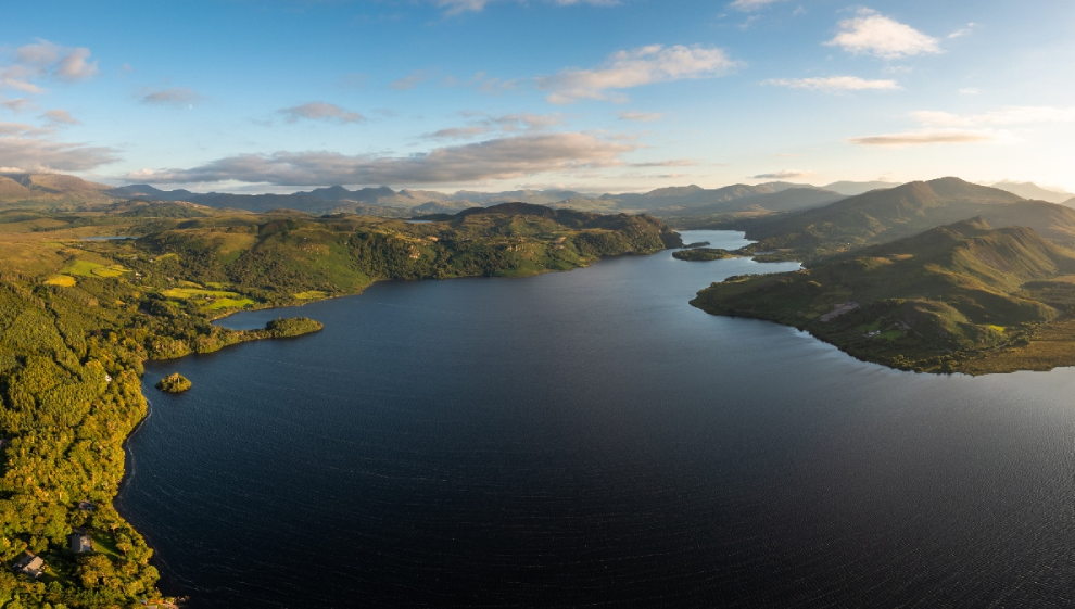
This well-trodden Mourne Mountains trail begins at Blue Lough and takes you along the Carrick Little trail before heading south towards the imposing Slieve Binnian.
Approximately 5 miles in length, this trail is home to mountainous terrain and intriguing geological sites. If waterside views and rolling hills are your thing, you’re in the right place.
On your way, you'll encounter the streams and tributaries of the Annolong River that meander through the region and the intriguing Douglas Crag quarries.
To begin your hike, make your way to Carrick Little car park, where you can easily access a trail that parallels the serene small lake. As you follow the path southward, you'll pass by Annolong Wood, Percy Bysshe outcrop, and the famous Slieve Binnian mountain, which rises to the west of your route.
This linear route spans approximately 2.5 miles, resulting in a round trip that’s approximately 5 miles. For those of you after a supplementary trek, consider the Slieve Binnian walk, which also commences at the Carrick Little car park.
6. Stairway to Heaven Boardwalk
- Distance: 4 miles
- Difficulty: medium
- Location: Cuilcagh Mountain, County Fermanagh
- Stairway to Heaven Boardwalk GPS route
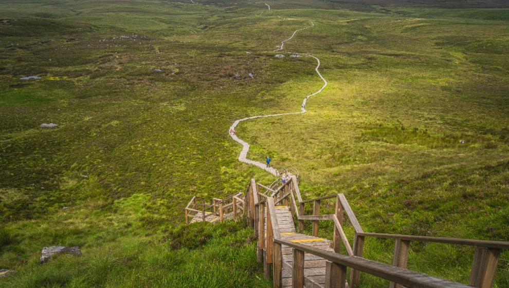
The Cuilcagh Boardwalk can be found in the Cuilcagh Mountain Park in County Fermanagh, Northern Ireland. Located near the town of Enniskillen, the Stairway to Heaven boardwalk is popular with tourists and locals alike.
This entirely unique attraction provides some of the most stunning views of the green marshland below. The boardwalk is a raised wooden pathway that was installed to protect the fragile and sensitive, boggy ecosystem of the Cuilcagh Mountain. It allows hikers to traverse the muddy and wet terrain without causing damage to the environment.
The boardwalk itself stretches for around 1 mile and is a significant part of the hiking experience in the area. Most trails and routes that move through the Cuilcagh area join onto the boardwalk.
What makes the Cuilcagh Boardwalk so unique is its combination of natural beauty and a sustainable and modern design. The juxtaposition of the wooden boardwalk against the rugged, wild terrain creates a striking visual contrast that adds to the allure of any hiking experience.
When it comes to photo opportunities, the Stairway to Heaven is unrivaled. Capture the winding wooden path stretching out across the bog or the lush greenery down below. The ever-changing light exposure and shadows on the landscape make for incredible photo opportunities. At the summit, you'll be rewarded with 360-degree views of the surrounding countryside, providing an opportunity to take some breathtaking photographs.
7. Slieve Donard Climb
- Distance: 5 miles
- Difficulty: hard
- Location: Mourne Area of Outstanding Natural Beauty
- Slieve Donard climb GPS route
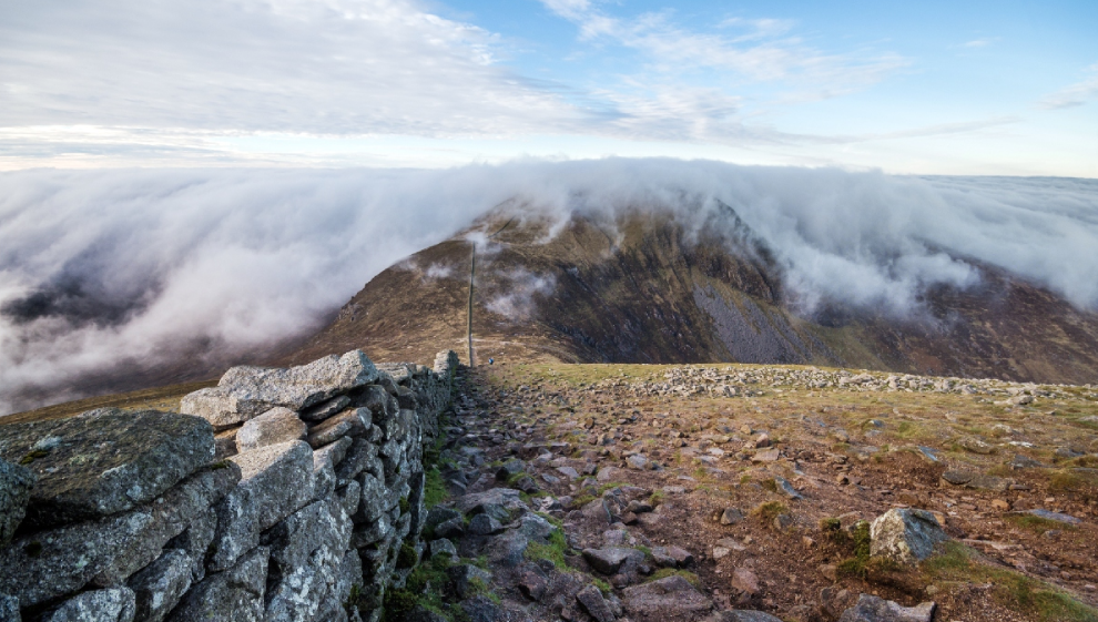
Slieve Donard is the highest peak in Northern Ireland and one of the most popular climbs in the UK for experienced mountaineers and outdoor enthusiasts.
Aside from the Donard climb, this stunning region is home to a captivating waterside stretch along the Glen River which is a true highlight of your journey. Along the river's path, you'll encounter rocky pools, charming waterfalls, and a serene woodland backdrop.
Your expedition starts in the charming coastal town of Newcastle in County Down. Setting out from the Donard Park car park, the trail meanders through the enchanting Donard Forest which is home to thousands of Scots Pine and Oak trees.
Follow the Glen River Path until your arrive at the Mourne Wall. Here, make a left turn, and align with the iconic Mourne Wall. This remarkable stone structure extends 22 miles through 15 different mountains. This historical wall was painstakingly constructed in the early 20th century, adding a layer of historical intrigue and heritage to your adventure.
When you reach the summit of Slieve Donard, take a moment to take in the panoramic views. On a clear day, you can see Newcastle Beach, the Isle of Man, Scotland, and Wales. The summit also boasts a quaint stone tower and two ancient burial cairns, adding a touch of historical intrigue to your journey and making for a great photo opportunity.
8. Portballintrae to Ballintoy Coastal Walk
- Distance: 13 miles
- Difficulty: hard
- Location: Causeway Coast Area of Outstanding Natural Beauty
- Portballintrae to Baillntoy coastal walk GPS route
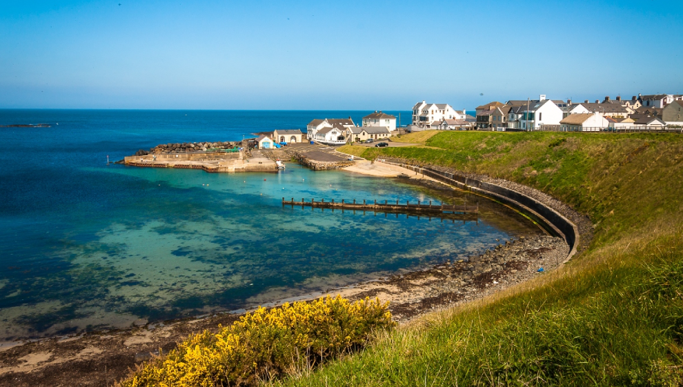
The journey from Portballintrae to Ballintoy is approximately 13 miles via Dunseverick and traces the stunning Causeway along the seafront. This refreshing costal route follows a waymarked footpath as you pass the extraordinary rock formations at the Giant's Causeway.
To get started, make your way to the charming Portballintrae harbor, where you'll head east. As you walk through Portnaboe and Bushmills, you'll see the National Trust's Giant's Causeway visitor center, which is an invaluable hub of information and interactive exhibitions on everything to do with the Causeway. Here, you can choose to pick up an audio guide or guided walking tour to enhance your hiking experience.
The Giant's Causeway is of course the jewel in the crown of the causeway coast. It stands as one of Northern Ireland’s premier attractions, boasting an astonishing geological insight into life millions of years in the past.
Continuing eastward, you'll pass by Bengore Head and eventually reach the photogenic ruins of Dunseverick Castle which is precariously perched on the cliff edge. These ancient remnants are believed to date back to the 5th century.
The trail then guides you through the picturesque village of Portbraddan, leading you on the sandy Whitepark Bay beach. The final leg of your journey unfolds along the shoreline before wrapping up in the charming harbour village of Ballintoy. Here, you'll discover an array of delightful shops, cafes, and restaurants.
If you’re looking for something extra, Ballintoy gives you the opportunity to pick up the Carrick-a-Rede Walk, where you can cross the renowned rope bridge to explore Carrick-a-Rede Island.
Last updated Wednesday 13 September 2023
First published on Wednesday 13 September 2023
