Walking in the UK | 8 great paths and routes in the northwest of England
If you’re a fan of the outdoors and are looking for a weekend getaway in the UK, the northwest is a great option to consider. A steady increase in tourism to the Lake District over the past three decades has made the area more accessible and far easier to visit.
What’s so special about hiking in the Northwest?
Northwest England boasts an extensive network of well-marked hiking trails, making it a hotspot for fans of traditional hiking routes. Ranging from gentle strolls to challenging mountain hikes, there’s something for everyone.
Because of the outdoor tourism the northwest generates, there’s a vibrant community of ramblers, hikers and walking groups in the region. Outdoor shops are everywhere and guided tours and hiking clubs are easy to find if a group hike is your thing.
Unlike other rural areas in the UK, the best paths and routes in the northwest are easily accessible if you’re staying in Liverpool or Manchester. The Lake District remains the obvious choice for outdoor enthusiasts, with the imposing figure of Scafell Pike towering over the skyline. Its picturesque array of crystal-clear lakes and high peaks make for a never-ending series of amazing photo opportunities.
A weekend away exploring the Cumbrian coast is another great option if you’re a fan of seaside walks and want something outside the Lake District.
1. Stock Ghyll
- Distance: 1 mile
- Difficulty: easy
- Location: Lake District, Cumbria
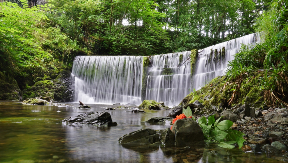
This secluded woodland walk spans little over a mile but crams a whole lot into a short space of time. The Stockghyll river runs downstream into the village of Ambleside via a series of stunning waterways that you’ll walk beside on your way up.
The climb is clearly marked and signposted and is a favourite amongst tourists flocking to the area in search of photogenic waterfalls and cascades.
2. Rivington Pike
- Distance: 2 miles
- Difficulty: easy
- Location: Bolton, Greater Manchester
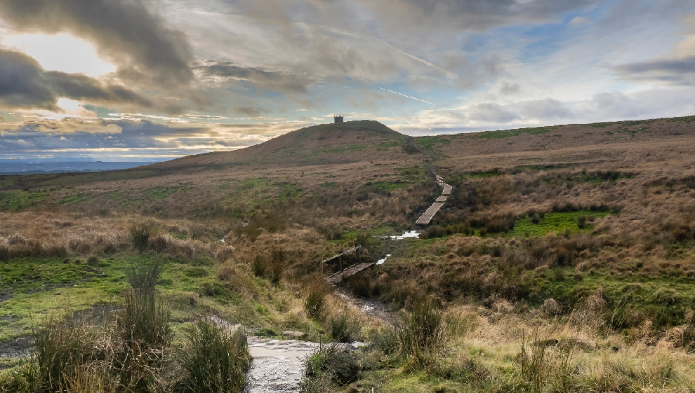
This two-mile circular hike is the jewel in the crown of the expansive Rivington Country Park (worth a lengthy visit) which is tucked away northwest of Bolton and just east of the Anglezarke Reservoir.
Setting off the from the Pigeon Tower car park, gradually make your way south until you reach Rivington Terraced Gardens. Of note as you continue south is the Pigeon Tower, which was built in 1910 by Lord Leverhulme.
If you’re looking for a break at this point, the stunning Japanese Gardens feature a tranquil lake that makes a great backdrop for a peaceful sit down or picnic break.
As you head up towards the Great Ravine, you’ll pass a series of stunning waterfalls that are entirely unique to the area. Upon exiting the gardens, you’ll begin your ascent up Rivington Pike. From here, the summit sits at 1,191 feet (363 metres). From the top you’ll be able to make out Blackpool Tower, the Lake District mountains, and the Welsh Mountains. You can even spot the Isle of Man on a clear day.
3. Catbells
- Distance: 4 miles
- Difficulty: easy
- Location: Lake District, Cumbria
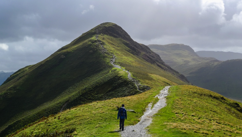
Lauded outdoorsman Alfred Wainwright once said of the Catbells “It is one of the great favourites where grandmothers and infants can climb together. A place beloved. Its popularity is well deserved”.
At an achievable height of around 450 metres (1,480 ft), the catbells peak it is not particularly high. With a gradual incline and a well-trodden and well-marked track all the way to the top, Catbells attracts walkers of all abilities for good reason. The views across the lakes both left and right as you ascend make the climb a must if you’re holidaying in the Lake District.
This climb starts at the Hawes End car park and ascends via the Skelgil Bank path to the top. Visible from the summit are Derwent Water, Bassenthwaite Lake, the Newlands Valley, Skiddaw, and the village of Keswick.
4. Buttermere Lake circular
- Distance: 4 miles
- Difficulty: easy
- Location: Lake District, Cumbria
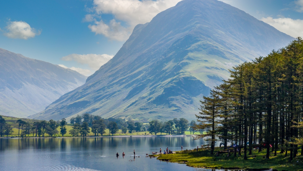
Buttermere sits at the foot of Fleetwith Pike and is surrounded by rolling hills. The lake is best known for it’s crystal clear water and stunning location.
Encircled by walking trails, Lake Buttermere has a relaxed and serene charm to it. Fishing is popular here, as large populations of Brown Trout call Buttermere home.
This particular trail starts in the village of Buttermere; however the track is reachable on foot from the popular town of Keswick on the Keswick.
Buttermere is a relatively small lake in comparison to some of the larger bodies of water in the region. For what Buttermere lacks in size, it makes up for in peaceful ambience. Windermere and Ullswater may be far larger, but if it’s scenic and tranquil trails that you’re after, Buttermere is a must visit.
5. Barbon Beck Barbondale
- Distance: 9 miles
- Difficulty: medium
- Location: Bullpot Farm, Cumbria
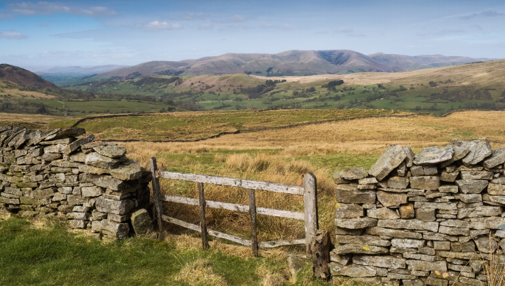
Situated inside the westerly section of the Yorkshire Dales National Park, this peaceful Cumbrian waterside walk is a great way to get away from the more populated walks and hikes in the northwest.
Kicking off in the village of Barbon (northeast of Kirkby Lonsdale), the Barbon Beck runs through to the River Lune which can itself be followed on a separate but worthwhile hike.
After leaving Barbon, you’ll want to head towards Eskhome Pike, which you’ll ascend before climbing Castle Knott Hill and Calf Top Hill. Fewer places in the Northwest give a more expansive view than the summit of Calf Top Hill (609m of elevation).
The trail continues downhill from Calf Top, leading you to Hanging Clint and Rowel Gill. At this point, transition onto a more manageable path that follows the beck through the scenic Barbondale. Along this route, you'll see a sequence of charming waterfalls and move through the final woodland section as you approach Barbon Manor.
The Barbon Beck trail hike is challenging, but well worthwhile. The seclusion of the rolling hills and the countryside views from the top of Calf Top Hill are not to be missed if you’re visiting the area.
6. Ennerdale Forest loop
- Distance: 12 miles
- Difficulty: medium
- Location: Lake District, Cumbria
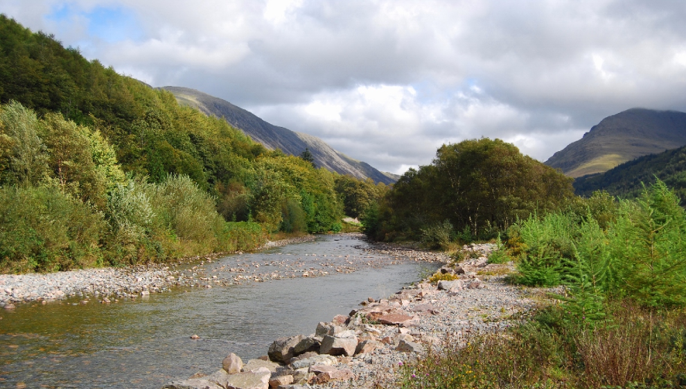
This 12 mile loop is the best way to see all the natural splendour that Ennerdale Forest has to offer.
Challenging and lengthy, this course can be cut into a few smaller loops if you’re looking for a hike that’s shorter and more accessible.
Ennerdale Forest is home to an abundance of wildlife, streams, forest and rock formations, and some of the highest and best-known fells in Cumbria. Situated at the westerly point of the Lake District, the seclusion and tranquillity of the forest has led many to liken the atmosphere to that of a Scottish or Scandinavian forest.
If you’re visiting, make sure to pay a trip to Ennerdale Water. This lake is a crystal clear body of water that can be marvelled at from the peaks of the mountains that surround it. Walking down to the shore and stopping for a picnic break is a great way to split this lengthy hike in two. If you’re after a separate challenge, you can even aim to hike the entire outer perimeter of the lake.
The Barbon Beck trail hike is challenging, but well worthwhile. The seclusion of the rolling hills and the countryside views from the top of Calf Top Hill are not to be missed if you’re visiting the area.
7. Solway coastal walk
- Distance: 23 miles
- Difficulty: hard
- Location: Solway Coast Area of Natural Beauty
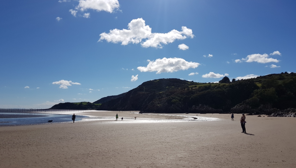
The Solway coastal path is made up in part of two of the most iconic walking trails in the northwest. The Cumbria coastal way and Hadrian’s Wall path are well-trodden and clearly waymarked routes that ensure you see the best bits of the Solway Coast Area of Natural Beauty.
The hike commences at Silloth, adjacent to the docks, and proceeds northward along the coastal path toward Skinburness and Grune Point. This section of the trail offers picturesque coastal views, including a particular good view of the Morecambe Estuary.
The vast saltmarshes and mudflats in the area attract a diverse array of wading birds, making it a prime spot for birdwatching. If you’re a fan of avian wildlife, make sure to pack your binoculars.
When you’ve rounded Grune Point, the trail veers eastward, leading you across Skinburness Marsh and Calvo Marsh on the way to Abbey Town. From here, head northward toward Newton Arlosh and Kirkbride, crossing the River Wampool via the Whitrigg Bridge.
You'll cross the charming Drumburgh Moss Nature Reserve which has international significance as an expanse of lowland raised mire. Keep an eye out for Curlew and red deer as you navigate this section of the hike.
The final leg of the journey is beautiful. As you pass the coast from Glasson to Port Carlisle and Bowness-on-Solway, you'll be treated to breath-taking views across the channel of the River Eden, with the Scottish town of Annan visible in the distance on a clear day.
8. Lake Windermere loop
- Distance: 41 miles
- Difficulty: hard
- Location: Lake Windermere, Cumbria
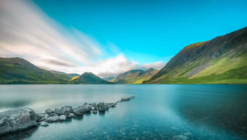
Until you visit, it can be hard to comprehend just how big Lake Windermere is. Lake Windermere is the longest lake in the UK at 10.5 miles (17 kilometres) and whilst not as deep as some of the other lakes in the district, its deepest section still reaches an eery 219ft.
Whilst it would be impossible to hike the entire trail in one go, the 41 miles that make up Windermere Way can be broken down into a series of tranquil hikes that showcase some of Windermere’s best bits.
The first section of the hike sees you visiting the Stockghyll Waterfall that we’ve already covered in this article. Remaining sections of this lengthy trail route see you visiting Townend (a 17th century slate farmhouse), Coniston Fells, Red Screes, and the village of Ambleside.
The neighbouring Wansfell Pike Walk gives a great view of Windermere and at a challenging but manageable 6 miles, is the perfect length for an afternoon.
Last updated Tuesday 19 September 2023
First published on Tuesday 19 September 2023
